Queensland.
Gulf line - maps.
Queensland
South Australia
Tasmania
Victoria
Western Australia
International
Special aspects
Gulf line - maps.
- Australia 1901-1988
- New South Wales
- Overview of NSW
- Telegraph lines
- Telegraph Offices
- Date stamps
- Forms
- Envelopes
- Instructional annotation
- Collect
- Delayed
- Free
- Immediate Urgent
- Reply paid
- Rates
- Stamps
- 1871 Telegraph stamps
- 1885 proposal
- 1893 proposal
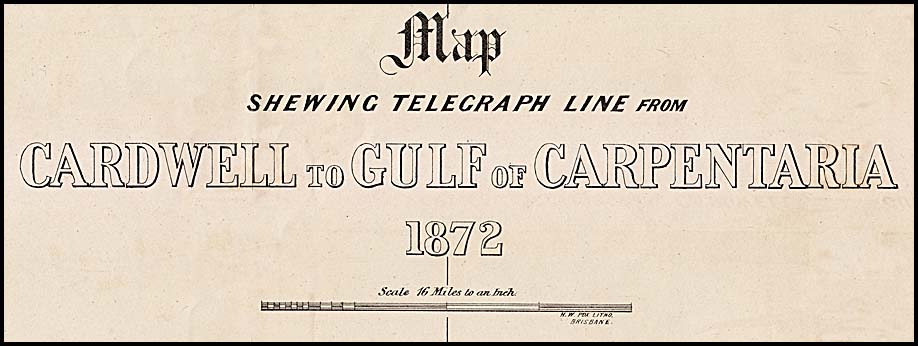
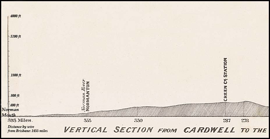
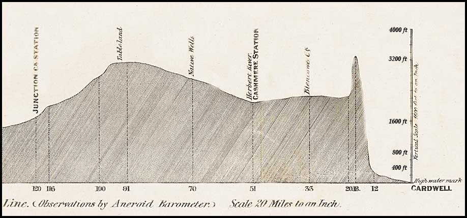
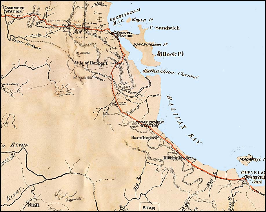
A map of the line from Cardwell to Normanton was published by the Government Engraving and Lithographic Office, Brisbane in 1872. It measures 56.5 × 80.5 cm. It is not possible to reproduce it here and still have details showing clearly. Hence it has been scanned to show the main components sequentially. The two main parts of the map are:
- the typographical aspects from the side showing the height above the high water line of the countryside;
- the directional aspects from above.
 |
 |
| The western third of the typographical map. Right side continues in the following map. |
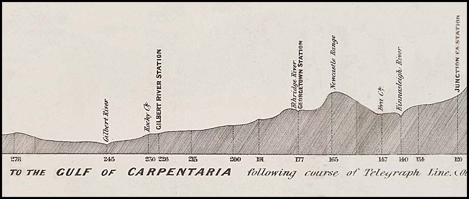 |
| The central third of the typographical map. Left side continues from the previous map and right side continues into the following map. |
 |
| The eastern third of the typographical map. Left side continues from the previous map. |
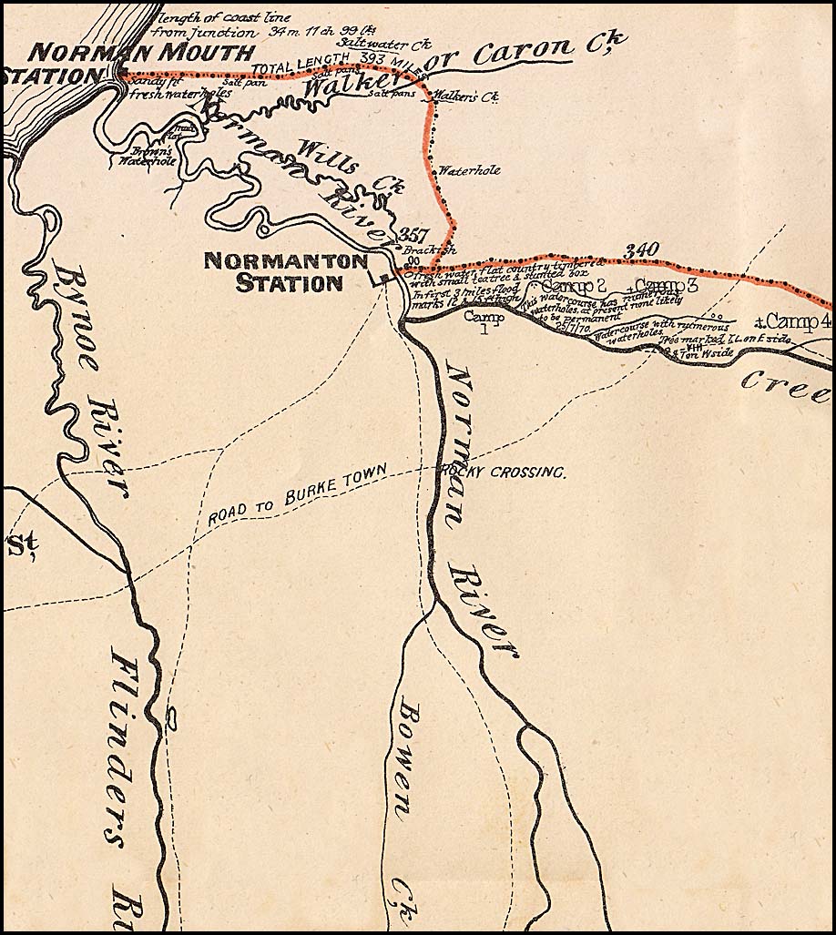
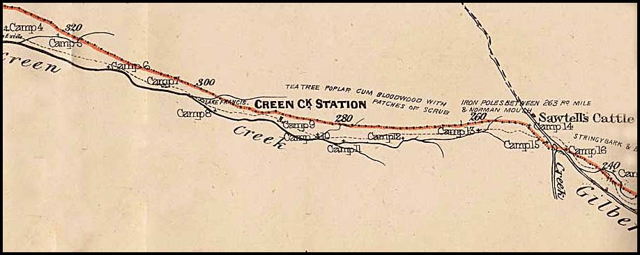
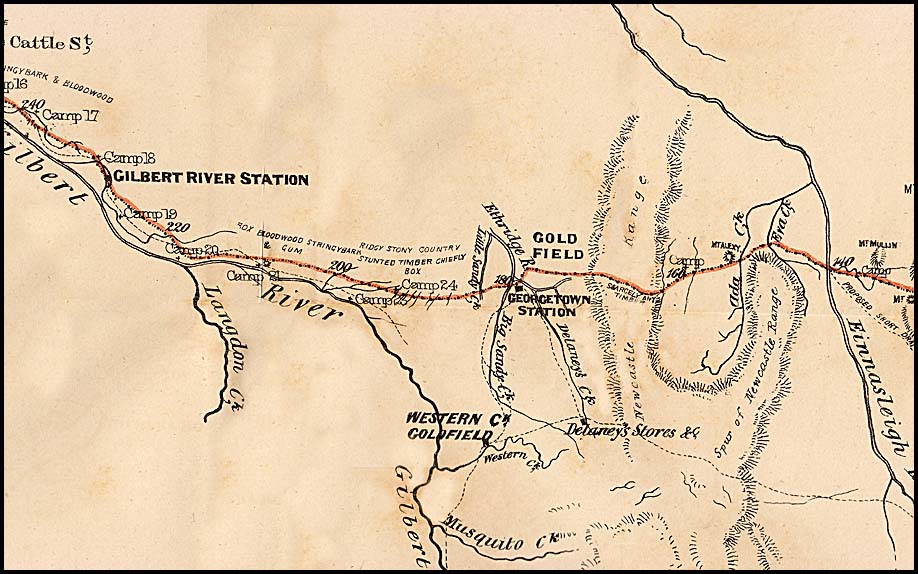
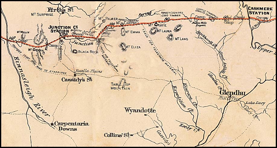
Maps showing the route from Normanton to Cardwell.
 |
 |
 |
 |
 |